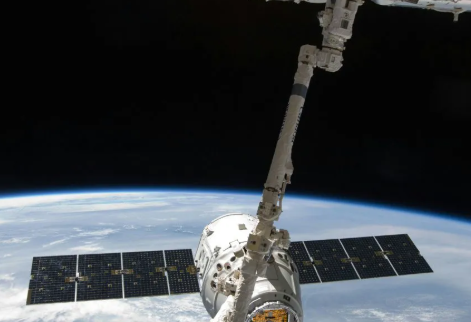
The Global Positioning System (GPS) is one of the most profound technological achievements of the modern era, an invisible utility that underpins countless aspects of our daily lives. Much like the Hubble Space Telescope opened our eyes to the distant cosmos, the GPS satellite network turned its focus inward, providing humanity with an unprecedented understanding of our own planet. It has evolved from a purely military tool into an indispensable global service, guiding everything from commercial airliners and container ships to your morning commute and pizza delivery. This guide explores the intricate workings of GPS, its critical technological evolution, and its far-reaching impact on society and science.
Understanding GPS is to understand a symphony of orbital mechanics, atomic physics, and relativistic effects working in perfect harmony. It is a testament to human ingenuity, a constellation of “eyes in the sky” that has fundamentally reshaped our world. We will delve into the core principles that make this system possible, trace its journey from older generations to the state-of-the-art GPS III satellites, and uncover its surprising applications in fields as diverse as astronomy and climate science.
The Fundamental Principles: How GPS Works
At its core, the Global Positioning System is a sophisticated “system of systems” comprising three main segments: the space segment (the satellites), the control segment (ground stations), and the user segment (your GPS receiver). The magic of pinpointing your location on Earth relies on a few foundational scientific principles executed with incredible precision.
The Satellite Constellation: The ‘Eyes in the Sky’
The space segment consists of a network of satellites orbiting the Earth at an altitude of approximately 20,200 kilometers (12,550 miles). This constellation is designed so that at least four satellites are “visible” from almost any point on the planet’s surface at any given time. Each satellite continuously broadcasts a signal containing two key pieces of information: its exact current position and the precise time the signal was sent. These signals travel at the speed of light, forming the basis for location calculation.
The Science of Trilateration
Your GPS receiver on the ground does not calculate its position based on angles, but on distances. This process is known as trilateration. The receiver picks up the signals from multiple satellites and calculates its distance from each one by measuring the time it took for the signal to travel from the satellite to the receiver. Since the signal travels at a known speed (the speed of light), the time delay directly translates to distance (Distance = Speed × Time). With the distance from one satellite, your position is known to be somewhere on the surface of a sphere with the satellite at its center. By receiving a signal from a second satellite, your location is narrowed down to the intersection of two spheres—a circle. A third satellite signal narrows your position down to just two points, and a fourth satellite is used to resolve which of the two points is correct and, crucially, to synchronize the receiver’s clock with the hyper-accurate satellite clocks.
The Crucial Role of Atomic Clocks and Relativity
The entire system’s accuracy hinges on timing. Each GPS satellite is equipped with multiple atomic clocks, which are incredibly precise timekeeping devices accurate to within a few nanoseconds (billionths of a second). A tiny error in timing can translate into a significant location error on the ground. Furthermore, GPS must account for Albert Einstein’s theories of relativity. Due to Special Relativity, the atomic clocks on the fast-moving satellites tick slightly slower than clocks on Earth. Due to General Relativity, the weaker gravitational pull at their high altitude causes their clocks to tick slightly faster. The net effect is that the satellite clocks run faster than ground clocks by about 38 microseconds per day. If this effect were not corrected, GPS-calculated positions would drift by as much as 10 kilometers (6 miles) every single day.

The Evolution of GPS: From IIF to the Advanced GPS III/IIIF
The GPS system is not static; it is constantly being upgraded to meet the growing demands for accuracy, reliability, and security. The transition from older satellite blocks, like GPS IIF, to the modern GPS III and its successor, GPS IIIF, represents a monumental leap in navigation technology.
Limitations of Earlier Generations (GPS IIF)
The GPS IIF (Follow-on) satellites, launched between 2010 and 2016, were the workhorses of the constellation for many years. They provided reliable service but had limitations that became more apparent as global dependency on GPS grew. Their signal strength was susceptible to interference in dense urban environments or under heavy tree canopy, and their design life was around 12 years. While revolutionary for their time, they lacked the advanced capabilities needed for future applications like autonomous vehicles and enhanced aviation safety.
A New Era of Precision: The GPS III Upgrade
The GPS III program, initiated by the U.S. Space Force, is the most significant modernization in the system’s history. These new satellites are designed to be more accurate, powerful, and resilient. The primary goal of the GPS III/IIIF series is to ensure the availability of PNT (Positioning, Navigation, and Timing) services for the next several decades while introducing new capabilities for both civilian and military users.
Key Technological Advancements in GPS III/IIIF
The superiority of the GPS III/IIIF satellites stems from several specific technological upgrades. These enhancements work together to provide a level of service that was previously unattainable.
- Stronger Signals: GPS III satellites broadcast with significantly more power, making their signals three times more powerful and up to eight times more resistant to jamming and interference than previous generations. This improves reception in challenging environments like urban canyons and mountainous terrain.
- New Civilian Signal (L1C): A major advancement is the introduction of the L1C civilian signal. This signal is designed to be interoperable with other global navigation satellite systems (GNSS), such as Europe’s Galileo, Russia’s GLONASS, and China’s BeiDou. This allows receivers to use satellites from multiple constellations simultaneously, dramatically increasing accuracy and availability.
- Enhanced Accuracy: The combination of better atomic clocks, more stable signals, and improved ground control systems allows GPS III to provide civilian users with an accuracy of 1-3 meters, a significant improvement over the 5-10 meter accuracy of older systems.
- Longer Lifespan: GPS III satellites are designed for a 15-year operational life, a 25% increase over the GPS IIF series. This ensures the long-term sustainability and reduces the frequency of costly replacement launches.

The Transformative Impact of GPS on Daily Life
While GPS was born from military necessity, its greatest impact has been on the civilian world. It has seamlessly integrated into the fabric of modern society, enabling technologies and industries that are now fundamental to our way of life.
Revolutionizing Navigation and Logistics
The most obvious application is navigation. From in-car systems and smartphone apps that provide real-time traffic updates to the complex flight management systems guiding commercial aircraft, GPS is the cornerstone of modern movement. The global logistics and supply chain industry relies on it to track shipments across oceans and continents, optimizing routes and ensuring timely deliveries. Precision agriculture uses GPS to guide tractors for planting and harvesting with centimeter-level accuracy, increasing crop yields and reducing waste.
Powering Critical Infrastructure and Emergency Services
GPS is the invisible heartbeat of much of our critical infrastructure. Emergency services—police, fire, and ambulance—use GPS to locate incidents and dispatch the nearest units, drastically reducing response times. The “Enhanced 911” system automatically provides a caller’s location to dispatchers. Construction and surveying industries depend on GPS for precise mapping and equipment guidance, ensuring that buildings, roads, and bridges are built exactly to specification.
Synchronizing the Global Financial and Communication Networks
Beyond location, the “T” in PNT—timing—is arguably GPS’s most critical function. The hyper-accurate time signals broadcast by GPS satellites are used to synchronize cellular networks, ensuring seamless call handoffs between towers. The global financial system uses these time stamps to securely record transactions on stock exchanges. Power grids are synchronized using GPS time to prevent blackouts, and data centers use it to keep their servers in perfect alignment. This precise global clock is a hidden utility that prevents chaos in our interconnected digital world.

Beyond Navigation: GPS as a Tool for Scientific Discovery
The same signals that guide your car also provide invaluable data for a wide range of scientific disciplines. The precision of the GPS network has turned it into a powerful instrument for observing our planet and the universe in new ways.
Aiding Astronomical Research and VLBI
In astronomy, precise timing is everything. Techniques like Very Long Baseline Interferometry (VLBI) combine data from multiple radio telescopes spread across the globe to create a virtual telescope the size of the Earth. This requires that the data from each telescope be time-stamped with extreme precision. GPS provides this crucial timing reference, enabling astronomers to create incredibly high-resolution images of cosmic objects like black holes and distant galaxies.
Monitoring Planet Earth: Geodesy and Climate Science
GPS is a primary tool for geodesy, the science of measuring the Earth’s shape, orientation, and gravity field. A global network of highly sensitive GPS ground stations can detect minute movements of the Earth’s crust, allowing scientists to monitor tectonic plate motion, predict volcanic eruptions, and assess earthquake risks. The signals can also be used to study the Earth’s atmosphere; by measuring the delay in GPS signals as they pass through the atmosphere, scientists can gather data on water vapor content, which is vital for weather forecasting and climate modeling. Furthermore, GPS helps monitor sea-level rise and the melting of polar ice sheets with unparalleled accuracy.
Enhancing Deep Space Exploration
While GPS signals don’t reach distant planets, the system plays a supportive role in deep space exploration. It provides the ultra-precise timing required for tracking and communicating with interplanetary spacecraft. The ground stations of the Deep Space Network rely on GPS-derived time and location data to accurately point their large antennas and synchronize communications with probes exploring the far reaches of our solar system.

The Future of Global Navigation Satellite Systems (GNSS)
The future of location-based technology is not just about GPS but about a global ecosystem of interconnected systems. The ongoing modernization of GPS is part of a broader trend towards more robust, accurate, and universally available PNT services.
Interoperability with Other Systems (Galileo, GLONASS, BeiDou)
As mentioned, the new L1C signal on GPS III satellites is a game-changer for interoperability. Modern receivers are no longer limited to using only GPS satellites. They can now lock onto signals from Europe’s Galileo, Russia’s GLONASS, and China’s BeiDou systems simultaneously. This multi-constellation approach, known as GNSS, means more visible satellites at any given time, leading to faster position fixes, higher accuracy, and greater reliability, especially in challenging signal environments.
Continued Modernization and Enhanced Security
The evolution will not stop with GPS III. The upcoming GPS IIIF (Follow-on) satellites will introduce even more advanced features, including fully digital navigation payloads, new military signals, and potentially a search and rescue payload. As our dependence on GNSS grows, so does the need to protect these systems from threats like jamming (intentional interference) and spoofing (broadcasting false signals). Future developments will heavily focus on enhancing the security and resilience of both the satellite signals and the ground control infrastructure to ensure these vital services remain trustworthy and available.
Frequently Asked Questions (FAQ)
- What is the main difference between GPS III and older GPS satellites?
- The main differences are that GPS III satellites are significantly more powerful, accurate, and resilient. They broadcast signals that are three times stronger, making them eight times more resistant to jamming. They also introduce the new L1C civilian signal for interoperability with other global systems like Galileo, have a longer 15-year lifespan, and provide greater accuracy for all users.
- How does Einstein’s theory of relativity affect GPS?
- Relativity has a direct and measurable impact on GPS. Due to their high speed (Special Relativity), satellite clocks slow down slightly. Due to their distance from Earth’s gravitational pull (General Relativity), their clocks speed up. The net effect is that the satellite clocks run about 38 microseconds faster per day than clocks on Earth. The system must constantly correct for this discrepancy; without the correction, location errors would accumulate at a rate of about 10 kilometers per day.
- Is GPS the only global navigation system?
- No, GPS is the system operated by the United States, but it is one of several Global Navigation Satellite Systems (GNSS). Other major systems include Russia’s GLONASS, the European Union’s Galileo, and China’s BeiDou Navigation Satellite System. Modern receivers can often use signals from multiple systems at once to improve performance.
- How does GPS contribute to astronomy?
- GPS provides the ultra-precise timing signal that is essential for techniques like Very Long Baseline Interferometry (VLBI). VLBI combines observations from radio telescopes around the world to create a virtual telescope the size of the planet. GPS synchronizes the data from these disparate telescopes with nanosecond accuracy, allowing astronomers to create detailed images of cosmic phenomena like the event horizons of black holes.
- Why is GPS accuracy so important for modern applications?
- Increasingly sophisticated technologies demand higher accuracy. While meter-level accuracy is sufficient for basic car navigation, emerging applications require much more precision. For example, autonomous vehicles need centimeter-level accuracy to stay within their lanes, precision agriculture uses it to optimize planting, and aircraft landing systems require it for safety in low-visibility conditions. The continuous improvement in GPS accuracy unlocks new technological possibilities.